Looking down Golden Canyon. 21 March 2009.
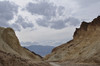
Golden Canyon, looking west, with a view of the Death Valley floor. 21 March 2009.
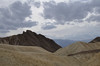
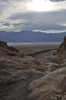
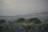
Above Golden Canyon, below Manley Beacon, looking west. 21 March 2009.
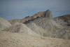
Above Golden Canyon, below Zabriskie Point. 21 March 2009.
View of Badwater Basin, from the foot of Gower Gulch, Death Valley. 21 March 2009.
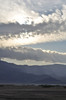
Death Valley, from foot of Golden Canyon. 21 March 2009.

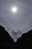
Amargosa Range and blowing sand near sunset. 21 March 2009.
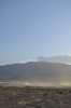
Sand blowing, Death Valley. 21 March 2009.
Blowing sand, Mesquite Flat sand dunes. 21 March 2009.
Blowing sand, Mesquite Flat sand dunes. 21 March 2009.
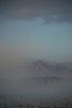
Amargosa Range in blowing sand at sunset. 21 March 2009.
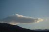
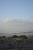
Cloud over Stovepipe Wells, Death Valley. 21 March 2009.
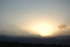
Sunset over the Panamints. 21 March 2009.